Explore the area’s geological wonders, touristic highlights, and natural heritage.
In this page you will find the maps of the Meteora – Pyli Geopark.
Each map offers a different perspective: from the geological structure and tourist routes to the protected areas of the NATURA 2000 network.
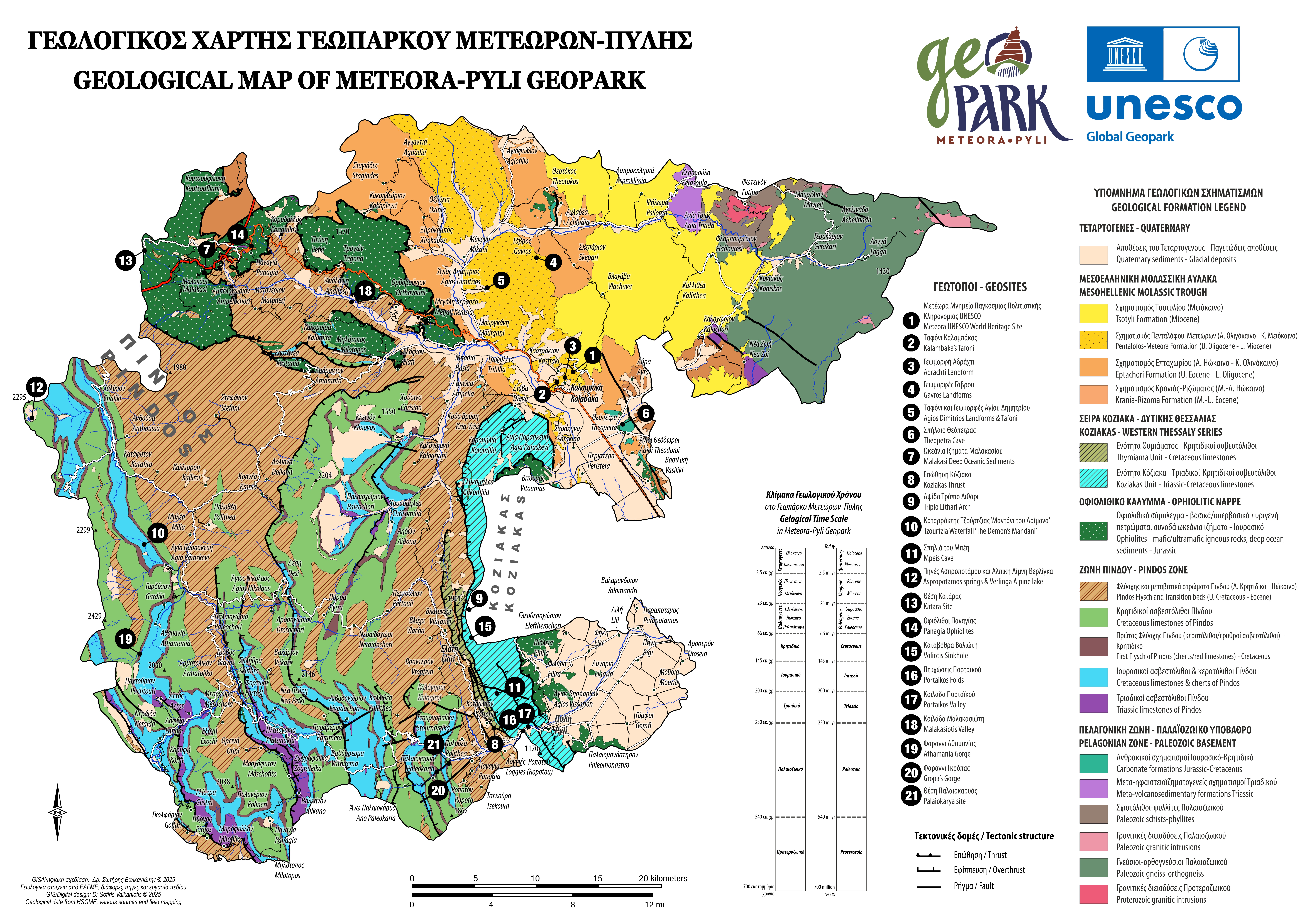
Geological Map
The geological map of the Meteora–Pyli Geopark highlights the rich geological heritage of the region, depicting formations shaped over millions of years of history. Through the use of different colors, the main geological zones are presented, ranging from the youngest Quaternary deposits to the oldest Paleozoic basement rocks, revealing the continuous evolution of the landscape. At the same time, the map showcases the Geopark’s significant geosites, twenty-one locations of unique natural, historical, and cultural interest that together shape its distinctive identity.
You can explore all Geological Geosites HERE.
Geotourism Map
The geotourism map of the Meteora–Pyli Geopark clearly presents the natural, geological, historical, and cultural landmarks that define its unique identity. It highlights the geosites, distinctive locations of geological importance, as well as areas of environmental, archaeological, and cultural interest. Special emphasis is given to the Kalabaka–Meteora area, where the iconic rock formations and monasteries, recognized as a UNESCO World Heritage Site, dominate the landscape.
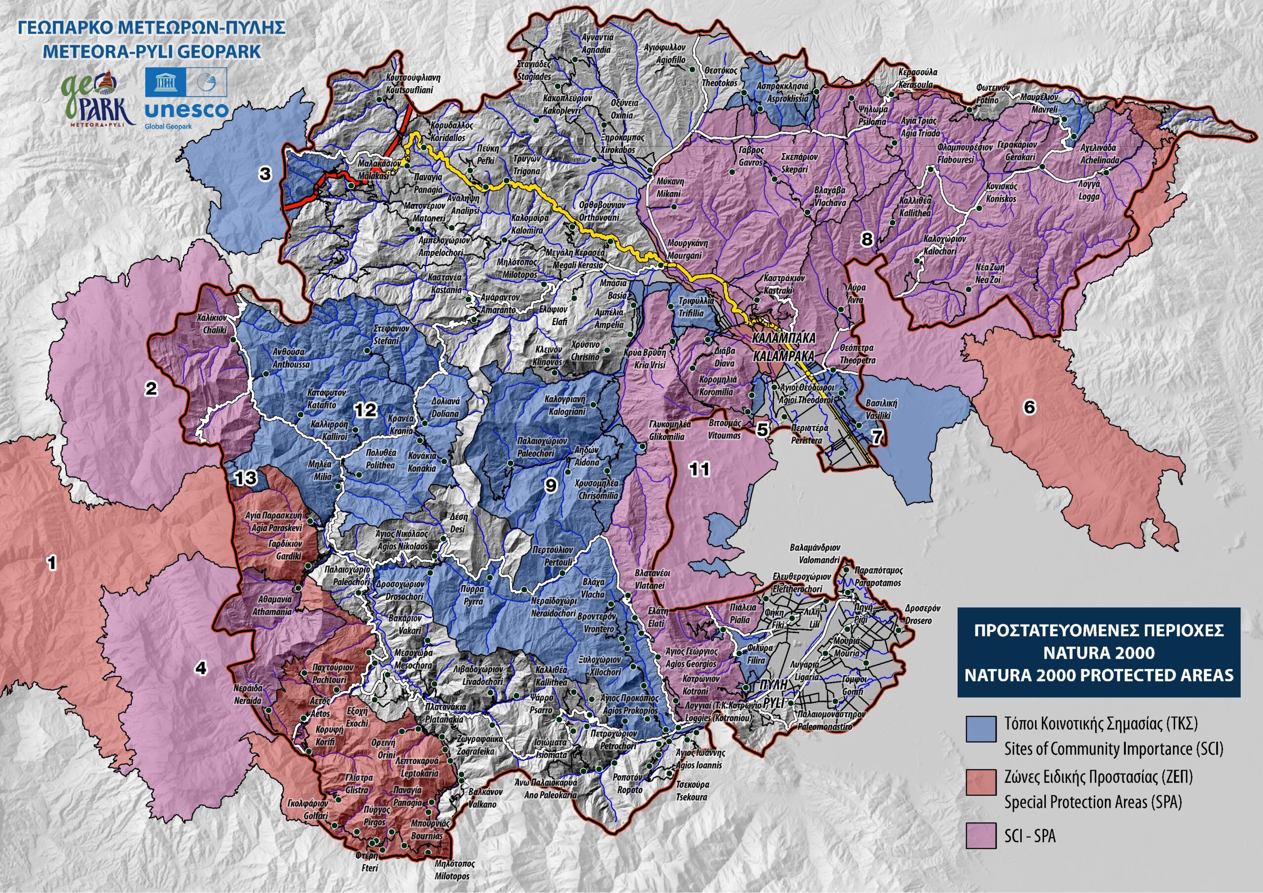
Protected Areas NATURA 2000
The Meteora – Pyli area includes nine (9) different protected natural areas that belong to the European NATURA 2000 network. These areas have been designated either as Special Areas of Conservation (SAC) according to the EU Habitats Directive for the protection of specific habitats and species of flora and fauna, or as Special Protection Areas (SPA) for birds, under the EU Birds Directive.
You can explore all the areas of the NATURA 2000 Network HERE.


