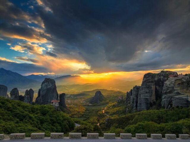
Category: Geoactivities
Discover unique geo-activities in the Meteora-Pyli Geopark! Enjoy rafting, skiing, hiking, climbing, cycling, truffle hunting and horseback riding in an enchanting natural landscape.
Biking
Mountain biking on forest trails, leading to landscapes of outstanding beauty where cars cannot be used.
Climbing
An exciting experience on the legendary rocks of Meteora, for beginners and experienced climbers.
Hiking
The best way to admire Meteora is to take a hike on its steep cliffs and admire the view from the monasteries.
Horse Riding
A unique walk at the foothills of Meteora, ideal for all ages. It brings relaxation and contact with nature.
Rafting & Canoe
Rafting in Meteora: A unique adventure on the Pinios River, with the imposing rocks as a backdrop. Ideal for all ages, it combines action and natural beauty.
Ski
Skiing and winter activities, with organized slopes in magnificent fir forests, suitable for all ages.
Truffle Hunting
It combines contact with nature, knowledge about mushrooms, but also the acquaintance with unprecedented culinary creations.
Technical Difficulty Easy – Medium Difficulty | Duration 3 hours Meeting in front of Meteora e-Bike office, (address is: Ioanninon 3) right in the center of Kalambaka. We pick and adjust our bikes and equipment. Your tour leader will lead you out on a 3-hour sightseeing tour by e-bikes. Hear…
View more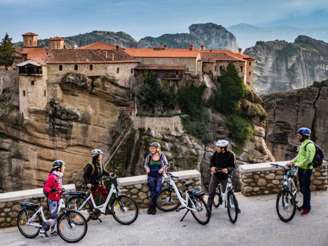
Technical Difficulty Easy – Medium Difficulty | Duration 4 hours Meeting in front of Meteora e-Bike office,(address is: Ioanninon 3) right in the center of Kalampaka. We pick and adjust our bikes and equipment. Your leader will lead you out on a 4-hour sightseeing and monastery visiting tour by e-bike….
View more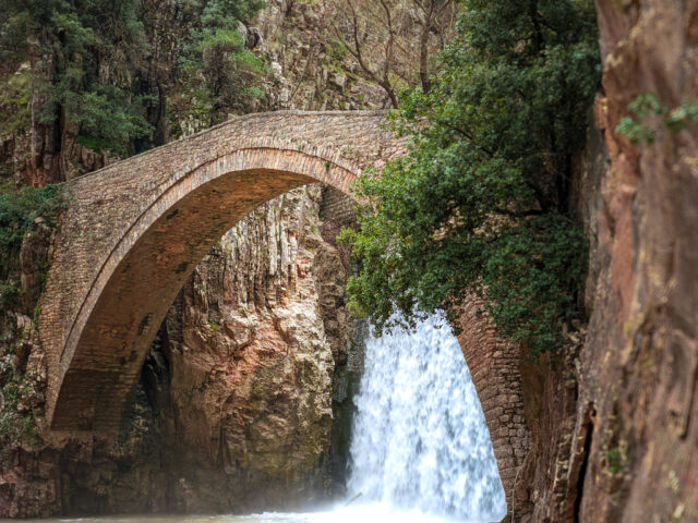
Distance 3,100.00 m. | Technical Difficulty Moderate | Max Altitude 442 m. | Duration 2 hours Hiking trail that starts from the stone bridge and waterfalls of Paleokarya and ends at the cemetery of Agios Ioannis, near the Watermill and Dristella of Ropotos. The route lasts approximately 120' in total….
View more
Distance 10,460.00 m. | Technical Difficulty Moderate | Max Altitude 2,038 m. | Duration 7 hours Hiking trail that starts from Mesochora and ends at Chatzi peak. The route takes about 7 hours. The trail starts from the center of Mesochora and 800 meters after the cemetery ascends to the…
View more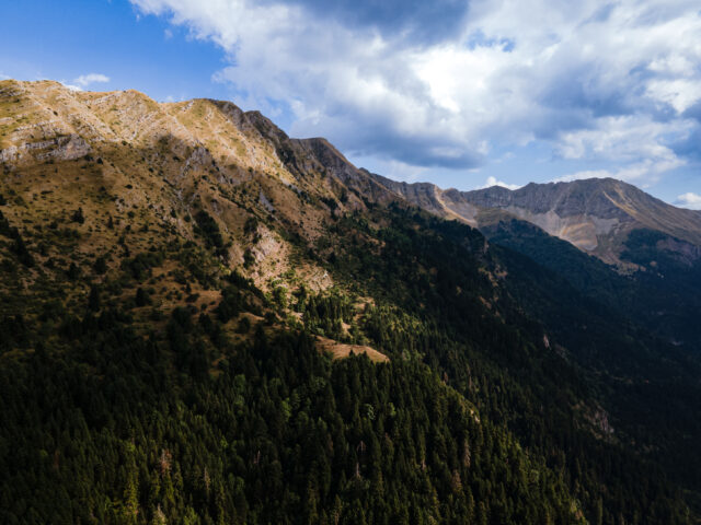
Distance 13,590.00 m. | Technical Difficulty Moderate | Max Altitude 1,966 m. | Duration 12 hours Hiking trail that starts from the Gardiki area and ends in the village of Pachtouri. The route lasts about 12 hours. The route is the classic climb to the top of Plun (Makria Rachi)…
View more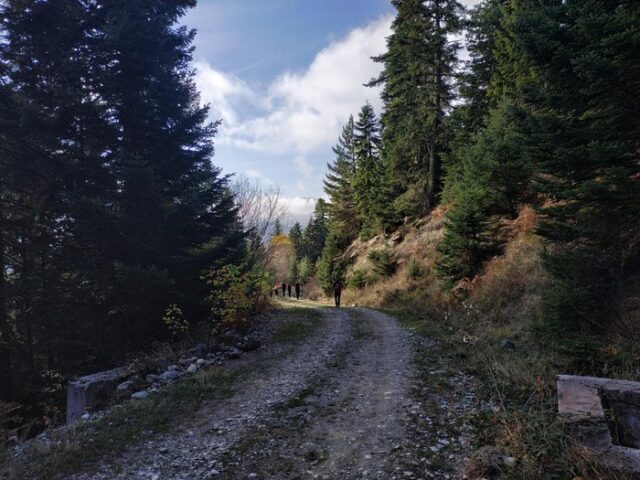
Distance 3,450.00 m. | Technical Difficulty Moderate | Max Altitude 1,342 m. | Duration 1 hour 50 minutes Hiking trail that starts from Pertouli and ends at the chapel of Agia Kyriaki in the meadows of Pertouli. The route lasts a total of 90'. The route ascends from the village…
View moreSEARCH
Looking for more?
Cras rutrum tellus et vulputate accumsan. Sed id ultricies mauris, nec semper nisl.

