Category: Geotourism
The Meteora-Pyli Geopark offers a complete geotourism experience, combining geological heritage with nature, tradition and local hospitality.
Geoactivities
Discover unique geo-activities in the Meteora-Pyli Geopark! Enjoy rafting, skiing, hiking, climbing, cycling, truffle hunting and horseback riding in an enchanting natural landscape.
Geofestivals
Experience the magic of the Geofestivals at Meteora-Gate Geopark! Events full of culture, tradition, flavours and natural beauties that connect nature with local heritage.
Geogift
With products made from natural ingredients of the geopark, visitors can take a piece of the authenticity and beauty of the place with them. Each gift tells a story connected to the geological wealth of the region.
Geohotels – Geohouses
Unique hospitality experience. Guests enjoy the warmth of the local way of life, genuine hospitality and the connection with the cultural heritage of the region.
Geopark Food
The GeoCafés and GeoRestaurants of the geopark are unique gastronomic destinations. With menus inspired by the geological elements of the region.
Georoutes
Discover the unique geological and cultural richness of the area through the Georoutes of the Meteora–Pyli Geopark. These carefully designed routes highlight impressive geological formations, biodiversity, and the deep connection between humans and nature that has shaped the landscape over the centuries.
Museums
Explore the museums of the Meteora-Gate Geopark! Discover the rich geological, cultural and historical heritage of the region through exhibits that bring history and nature to life.
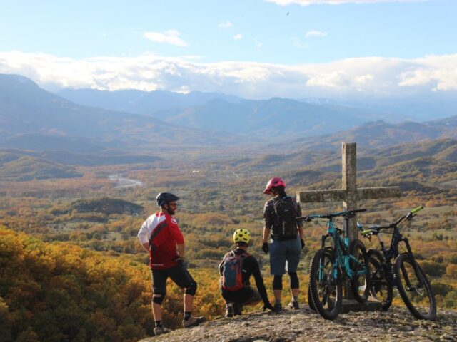
Technical Difficulty Easy – Medium Difficulty | Duration 3 hours Meeting in front of the Meteora e-Bike office (address: 3 Ioannina Street) right in the center of Kalambaka. We sort and adjust your bikes and equipment. The mtb guide will lead you on a 2 1/2 hour mountain bike tour,…
View more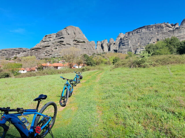
Technical Difficulty Easy – Medium Difficulty | Duration 4 hours Meeting in front of Meteora e-Bike office,(address is: Ioanninon 3) right in the center of Kalampaka. We pick and adjust our bikes and equipment. Your leader will lead you out on a 4-hour sightseeing ride around the old part of…
View more
Technical Difficulty Easy – Medium Difficulty | Duration 3 hours Meeting in front of Meteora e-Bike office, (address is: Ioanninon 3) right in the center of Kalambaka. We pick and adjust our bikes and equipment. Your tour leader will lead you out on a 3-hour sightseeing tour by e-bikes. Hear…
View more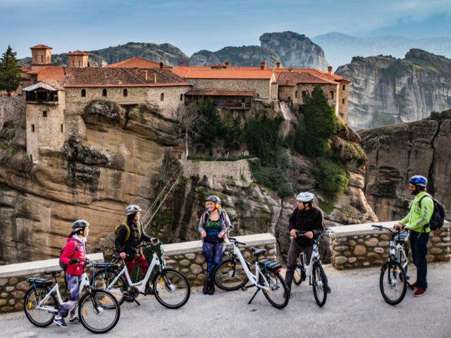
Technical Difficulty Easy – Medium Difficulty | Duration 4 hours Meeting in front of Meteora e-Bike office,(address is: Ioanninon 3) right in the center of Kalampaka. We pick and adjust our bikes and equipment. Your leader will lead you out on a 4-hour sightseeing and monastery visiting tour by e-bike….
View more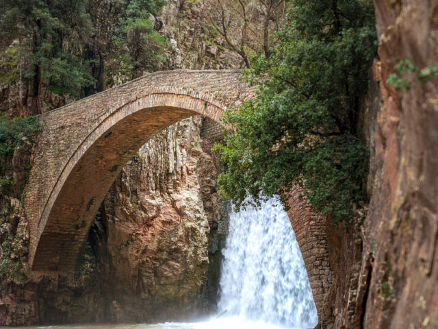
Distance 3,100.00 m. | Technical Difficulty Moderate | Max Altitude 442 m. | Duration 2 hours Hiking trail that starts from the stone bridge and waterfalls of Paleokarya and ends at the cemetery of Agios Ioannis, near the Watermill and Dristella of Ropotos. The route lasts approximately 120' in total….
View more
Distance 10,460.00 m. | Technical Difficulty Moderate | Max Altitude 2,038 m. | Duration 7 hours Hiking trail that starts from Mesochora and ends at Chatzi peak. The route takes about 7 hours. The trail starts from the center of Mesochora and 800 meters after the cemetery ascends to the…
View moreSEARCH
Looking for more?
Cras rutrum tellus et vulputate accumsan. Sed id ultricies mauris, nec semper nisl.

